
Iran Publishes “Hormuz Maritime Control Zone” Map, Declares All Ships Must Obtain Permission From PGSA
Iran’s Persian Gulf Management Organization (PGSA) on May 21 released a new maritime control map covering key sections of the Strait of Hormuz, declaring that all vessels transiting the area must coordinate with Iranian authorities and obtain prior authorization.
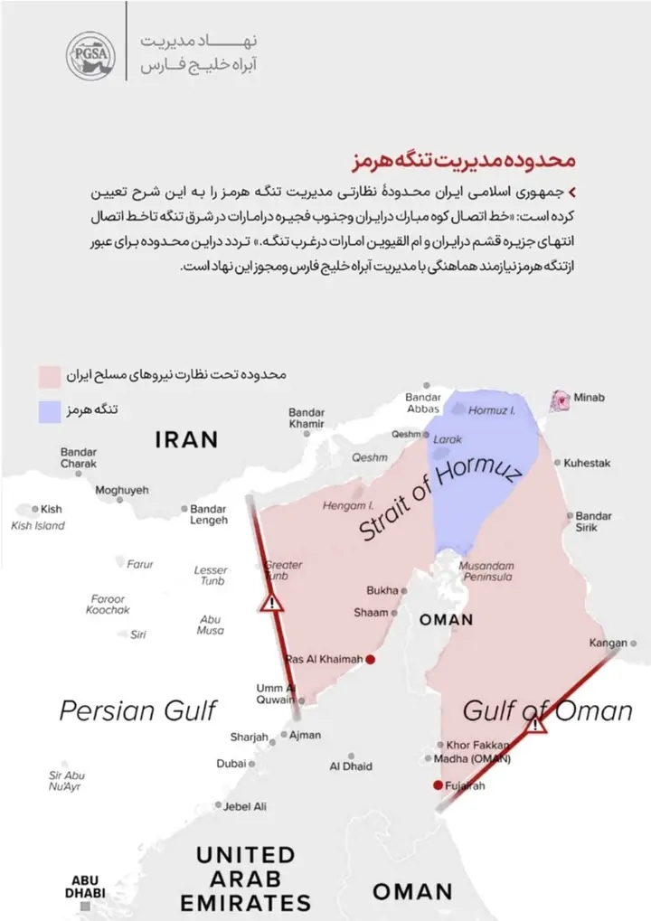
According to the announcement, the highlighted “pink zone” marks waters now placed under the supervision of the PGSA — an organization reportedly operating under the control of Iran’s Islamic Revolutionary Guard Corps (IRGC).
The eastern boundary stretches from Kuh-e Mubarak in Iran to the southern coast of Fujairah in the UAE, while the western boundary runs from Iran’s Qeshm Island toward Umm Al-Quwain in the UAE.
Iranian authorities stated that “all navigation through the Strait of Hormuz within this sector requires coordination with the Persian Gulf waterway administration and authorization from PGSA.”
The move is expected to heighten tensions across the Gulf region, as the Strait of Hormuz remains one of the world’s most strategically critical oil shipping routes, handling a major share of global energy exports.
Analysts warn the announcement could be interpreted by Western and Gulf nations as an attempt by Tehran to tighten operational control over international maritime traffic amid ongoing regional tensions.